
Cargando...
Trova
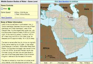
Click on the correct sea or bay.
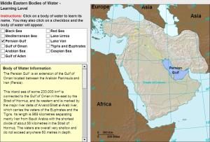
Learn the seas and bays of the Middle East!
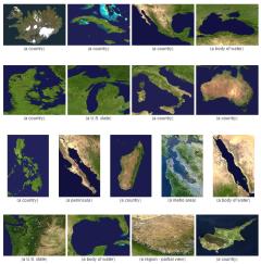
Guess what country or territory is pictured in these satellite images.
It is an educational content by JetPunk, site that contains a wide variety of quizzes.
Which countries are closest to the Red Sea?
It is an educational content by JetPunk, site that contains a wide variety of quizzes.
Name all the countries with coastlines on the Red Sea.
It is an educational content by JetPunk, site that contains a wide variety of quizzes.
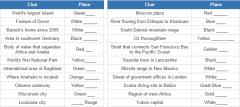
Given the clues, fill the blanks in the names of these places.
It is an educational content by JetPunk, site that contains a wide variety of quizzes.
Aggiungere a Didactalia Arrastra el botón a la barra de marcadores del navegador y comparte tus contenidos preferidos. Más info...


