
Cargando...
5092 mapasInteractivos
textoFiltroFichatipo de documento
About this resource...
Mapa para imprimir de los Nenets
Mapa político de los Nenets (pueblo de Siberia). GRID-Arendal
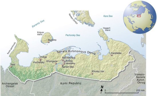
Aprende con este sencillo mapa la localización geográfica del pueblo de los Nénets, en Siberia – Rusia.
Es un contenido publicado en www.grida.no
Geographical Information“Map, illustrating the communites, cities and sites from where the stories for the 'Indigenous Knowledge in Disaster Management' project has been collected and are refered to in the stories.”
This is a content published at www.grida.no
Europa
Idioma English
Autores:
Categories:
Tags:
Shared with:
Add to Didactalia Arrastra el botón a la barra de marcadores del navegador y comparte tus contenidos preferidos. Más info...

")


Compartir en: