
Cargando...
5092 mapasInteractivos
textoFiltroFichaAbout this resource...
Mapa para imprimir del mar Báltico
Un sencillo mapa en color, listo para imprimir con los países que rodean el mar Báltico.
Es un contenido publicado en www.grida.no
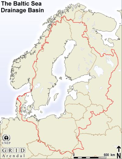
Geographical Information“This 'basemap' displays the extent of the drainage basin (the boundary for the water that ends up in the Baltic Sea), and the countries in the region. The drainage basin represents all water that drains into the sea, through rivers and ground water.”
This is a content published at www.grida.no
Europa
Idioma English
Autores:
Categories:
Tags:
Shared with:
Add to Didactalia Arrastra el botón a la barra de marcadores del navegador y comparte tus contenidos preferidos. Más info...

")


Compartir en: