
Cargando...
5092 mapasInteractivos
textoFiltroFichatipo de documento Download Anfahrtskarte
Über diese Ressource...
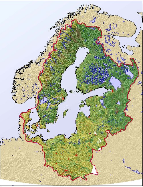
Mapa para imprimir del mar Báltico
Para aprender el relieve de la región del mar Báltico, te proponemos este mapa en color, listo para imprimir. El mapa representa la situación en torno al año 2000.
Es un contenido publicado en www.grida.no
Geographical Information
“The Baltic Sea region is covered by primarily forested land and cropland. This land cover map, delineated for the Baltic Sea drainage basin, is using the dataset prepared through the BALANS project, and represents the situation around year 2000.”
This is a content published at www.grida.no
Europa
Autores:
Kategorien:
Geteilt mit:
Add to Didactalia Arrastra el botón a la barra de marcadores del navegador y comparte tus contenidos preferidos. Más info...

")


Compartir en: