
Cargando...
Finden
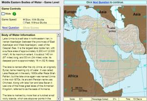
Click on the correct sea or bay.
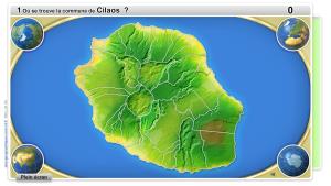
Répondez au plus grand nombre de questions possible en trois minutes. Vous devez indiquer sur la carte exactement où se trouve chaque côte, rivière, village,.. .
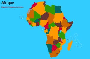
Sauriez-vous localiser sur la carte chaque pays d'Afrique? Vous devez indiquer sur la carte exactement où se trouve chacune.Es un mapa de la colección EastDock Media.
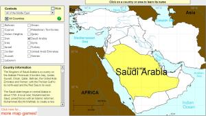
Click on Middle East countries to find their names.
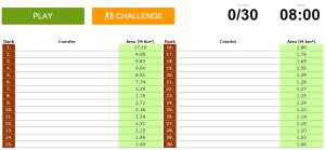
Can you name the world's largest countries in the world?
Potrebbe trovare caratteristiche geografiche che vengono richiesti sulla mappa? È necessario indicare ogni posizione precisa sulla mappa.
Individuare le caratteristiche geografiche sono le seguenti: Be ...
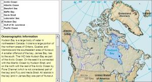
Learn the bays, seas and other ocean features around Canada by clicking on them.
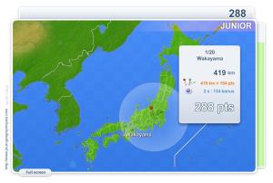
You have to click as close as possible to the city requested. Your scores are calculated based on the distance between your click and the true location. There is a time bonus each time.
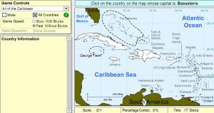
Pick the correct country for the highlighted capital.
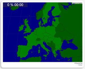
Train je brein met topografie.
Zoek geografische kenmerken zijn: België, Bulgarije, Cyprus, Denemarken, Duitsland, Estland, Finland, Frankrijk, Griekenland, Hongarije, Ierland, Italië, Kroatië, Letland ...
Könntest du, die geographische Objekte ausfindig machen? Du musst auf die Landkarte genau zeigen, wo jeder sich befindet.
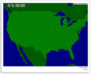
Die geographischen objekte, positionieren sollten, sind: Alabama, Arizona, Arka ...
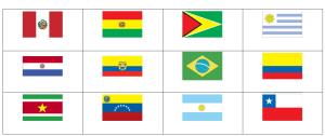
Can you name the flags of South America?
Add to Didactalia Arrastra el botón a la barra de marcadores del navegador y comparte tus contenidos preferidos. Más info...


