
Cargando...
Encuentra
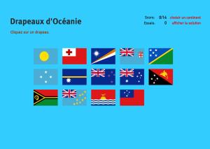
Cliquez sur chacun des 14 drapeaux disponibles et détail à quel pays d'Océanie ils appartient.Es un mapa de la colección EastDock Media.
Click on the flag of each given country of Oceania.
Can you name all the countries of Oceania? You have five minutes to done it.
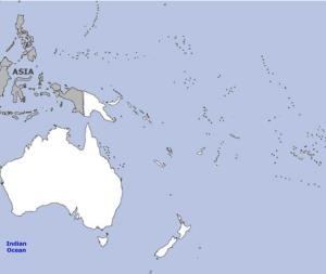
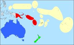
Try to find out on the map each given islands of Oceania.
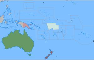
Sauriez-vous localiser sur la carte chaque Pays? Vous devez indiquer sur la carte exactement où se trouve chacun.
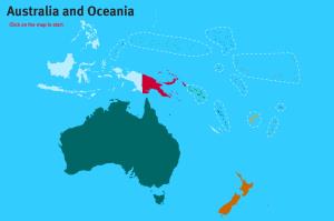
Would you know to locate the countries of Australia and Oceania you are asked about? You must point out each exact location on the map.Es un mapa de la colección EastDock Media.
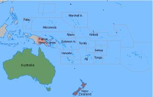
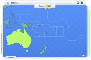
Guess where each given country of Oceania is located on the map.

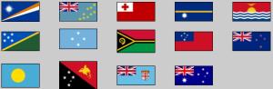
Try to figure out the flag of each given country.
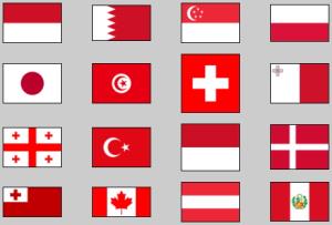
Try to guess the countries that have the colours red and white on their flags.

Enter the countries that have been British at some point in history, no matter how short the period.
It is an educational content by JetPunk, site that contains a wide variety of quizzes.
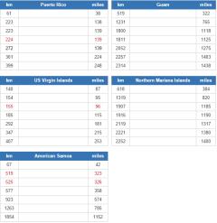
Which countries are closest to each of the US's five inhabited territories (Puerto Rico, US Virgin Islands, Guam, Northern Mariana Islands and American Samoa)? Excludes uninhabited offshore islands.
It ...
Haz clic en el nombre de cada país de Oceanía, que aparece en el mapa seleccionado con el color azul. Si aciertas, el país se colorea de verde, si fallas, se colorea de rojo.
It is an educational conte ...
Añadir a Didactalia Arrastra el botón a la barra de marcadores del navegador y comparte tus contenidos preferidos. Más info...


