
Cargando...
Encuentra
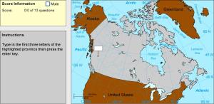
Type the first three letters of the province or territory's name (no outlines given).
Train je brein met topografie.
Zoek geografische kenmerken zijn: Belize, Canada, Costa Rica, Cuba, Dominicaanse Republiek, El Salvador, Guatemala, Haïti, Honduras, Jamaica, Mexico, Nicaragua, Panama, V ...
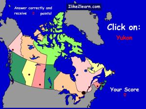
Learn the names and locations of the provinces and territories in Canada with this interactive quiz.

Drag each province or territory onto the map by region.
Potrebbe trovare caratteristiche geografiche che vengono richiesti sulla mappa? È necessario indicare ogni posizione precisa sulla mappa.
Individuare le caratteristiche geografiche sono le seguenti: Af ...
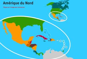
Sauriez-vous localiser sur la carte chaque pays d'Amérique du Nord? Vous devez indiquer sur la carte exactement où se trouve chacune.Es un mapa de la colección EastDock Media.
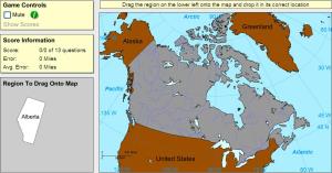
Drag each province or territory onto the map (both disappear).
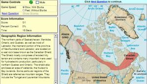
Click on the correct geographic region.
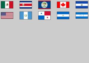
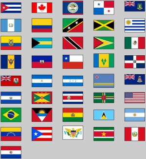
Click on the flag of each given country of North and Central America.
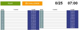
Can you name the countries with the longest coastlines?

Train je brein met topografie.
Zoek geografische kenmerken zijn: Afghanistan, Algerije, Angola, Argentinië, Australië, Bolivia, Botswana, Brazilië, Canada, Centraal Afrikaanse Republiek, China, Colombi ...
Try to guess all the flags of the 2015 Pan American Games.
Añadir a Didactalia Arrastra el botón a la barra de marcadores del navegador y comparte tus contenidos preferidos. Más info...


