
Cargando...
Encuentra
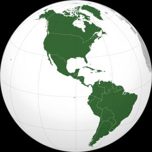
América tiene una superficie de más de 42 milones de km², cubriendo el 8,3 % de la superficie total del planeta y el 30,2 % de la tierra emergida, y además concentra cerca de ...
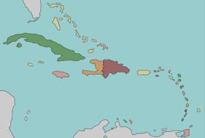
Try to locate on the map the given countries of the Caribbean.
Train je brein met topografie.Es un mapa de la colección EastDock Media.
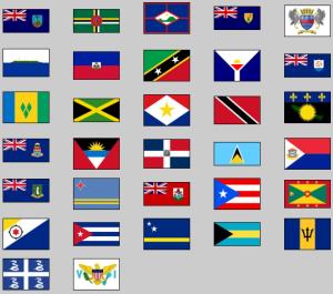
Click on the flag of each given country of the Caribbean.
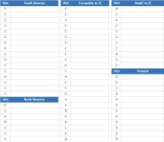
Enter all world countries together with their capitals (if exists) as answers. Quiz includes sovereign nations, dependencies, disputed nations, and overseas/autonomous regions(does not include antarct ...
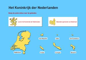
Write down all the islands of the Netherlands in the Caribbean.
It is an educational content by JetPunk, site that contains a wide variety of quizzes.
The Americas are the second-largest landmass on Earth; it could be a giant continent except that is considered to contain two of them. Which are the nearest countries to the single landmass of The Ame ...
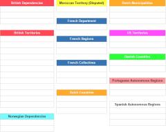
Name these territories, departments, and autonomous regions that touch the Atlantic Ocean (including Caribbean and Mediterranean).
It is an educational content by JetPunk, site that contains a wide var ...
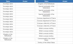
Name all the states and territories in the Caribbean.
It is an educational content by JetPunk, site that contains a wide variety of quizzes.
Añadir a Didactalia Arrastra el botón a la barra de marcadores del navegador y comparte tus contenidos preferidos. Más info...


