
Cargando...
Troba
Ydych chi'n gwybod sut i leoli nodweddion daearyddol i gyd yn gywir? Gallwch chi ddangos hyn trwy gwblhau'r map rhyngweithiol gwreiddiol.
Gwledydd o hyd yw: An Aetóip, An Afraic Theas, An Ailgéir, An B ...

Könntest du, die geographische Objekte ausfindig machen? Du musst auf die Landkarte genau zeigen, wo jeder sich befindet.
Die geographischen objekte, positionieren sollten, sind: Angola, Äquatorialguin ...
Potrebbe trovare caratteristiche geografiche che vengono richiesti sulla mappa? È necessario indicare ogni posizione precisa sulla mappa.
Individuare le caratteristiche geografiche sono le seguenti: An ...

Ydych chi'n gwybod sut i leoli nodweddion daearyddol i gyd yn gywir? Gallwch chi ddangos hyn trwy gwblhau'r map rhyngweithiol gwreiddiol.
Gwledydd o hyd yw: An Afraic Theas, An Bhotsuáin, An Bhurúin, A ...
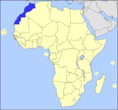
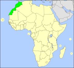
Haz clic en el nombre de cada país africano, que aparece en el mapa seleccionado con el color azul.
It is an educational content by JetPunk, site that contains a wide variety of quizzes.
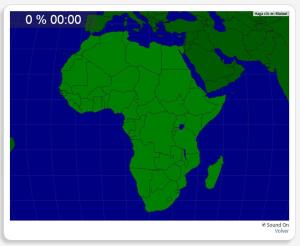
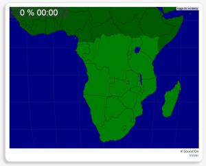
Escribe el nombre de todos los países que forman el continente africano. En cuanto aciertes, se colorea de verde, en el mapa, el país correspondiente.
It is an educational content by JetPunk, site that ...
Afegir a Didactalia Arrastra el botón a la barra de marcadores del navegador y comparte tus contenidos preferidos. Más info...


