
Cargando...
Encontrar
Ydych chi'n gwybod sut i leoli nodweddion daearyddol i gyd yn gywir? Gallwch chi ddangos hyn trwy gwblhau'r map rhyngweithiol gwreiddiol.
Gwledydd o hyd yw: An Aetóip, An Afraic Theas, An Ailgéir, An B ...

Sauriez-vous localiser sur la carte chaque entité géographique? Vous devez indiquer sur la carte exactement où se trouve chacune.
Localiser les entités géographiques sont les suivants: Afrique du Sud, ...
Potrebbe trovare caratteristiche geografiche che vengono richiesti sulla mappa? È necessario indicare ogni posizione precisa sulla mappa.
Individuare le caratteristiche geografiche sono le seguenti: An ...

Train je brein met topografie.
Zoek geografische kenmerken zijn: Angola, Botswana, Burundi, Congo Brazzaville, Democratische Republiek Congo, Equatoriaal Guinea, Gabon, Kenia, Lesotho, Madagascar, Mala ...

Train je brein met topografie.
Zoek geografische kenmerken zijn: Afghanistan, Algerije, Angola, Argentinië, Australië, Bolivia, Botswana, Brazilië, Canada, Centraal Afrikaanse Republiek, China, Colombi ...

Ydych chi'n gwybod sut i leoli nodweddion daearyddol i gyd yn gywir? Gallwch chi ddangos hyn trwy gwblhau'r map rhyngweithiol gwreiddiol.
Gwledydd o hyd yw: An Afraic Theas, An Bhotsuáin, An Bhurúin, A ...
Ydych chi'n gwybod sut i leoli nodweddion daearyddol i gyd yn gywir? Gallwch chi ddangos hyn trwy gwblhau'r map rhyngweithiol gwreiddiol.
Gwledydd o hyd yw: An Aetóip, An Afganastáin, An Afraic Theas, ...
From a point in the Indian Ocean equidistant from mainland Africa, mainland Asia, and Australia, what are the nearest countries?
It is an educational content by JetPunk, site that contains a wide varie ...
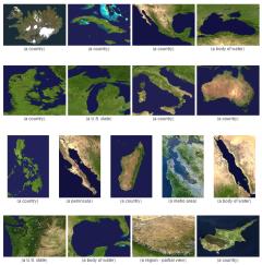
Guess what country or territory is pictured in these satellite images.
It is an educational content by JetPunk, site that contains a wide variety of quizzes.
Enter the 40 countries that do not share a border with any other country.
It is an educational content by JetPunk, site that contains a wide variety of quizzes.
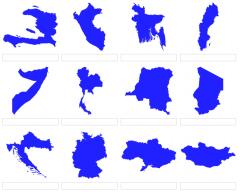
Based on the given shapes, guess the country refers to!
It is an educational content by JetPunk, site that contains a wide variety of quizzes.
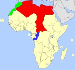
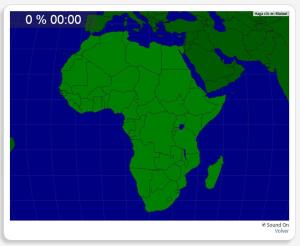
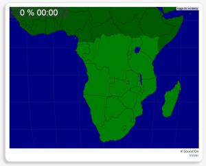
Fill in the map of Africa by correctly guessing each highlighted country.
It is an educational content by JetPunk, site that contains a wide variety of quizzes.
Adicionar ao Didactalia Arrastra el botón a la barra de marcadores del navegador y comparte tus contenidos preferidos. Más info...


