
Cargando...
Trouvez
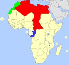
Fill in the map of Africa by correctly guessing each highlighted country.
It is an educational content by JetPunk, site that contains a wide variety of quizzes.
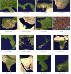
Based on the satellite images, can you guess the countries or territories they represent?
It is an educational content by JetPunk, site that contains a wide variety of quizzes.
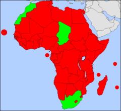
Name every country that is generally considered to be part of Africa.
It is an educational content by JetPunk, site that contains a wide variety of quizzes.
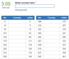
Which countries lie closest to Africa?
It is an educational content by JetPunk, site that contains a wide variety of quizzes.
Ajouter à Didactalia Arrastra el botón a la barra de marcadores del navegador y comparte tus contenidos preferidos. Más info...


