
Cargando...
Find
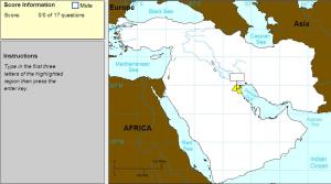
Type the first three letters of the country's name.
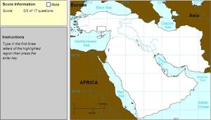
Type the first three letters of the country's name (no outlines given).
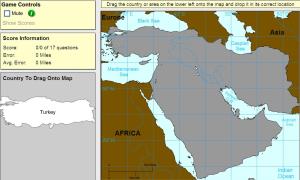
Drag each country onto the map (countries disappear).
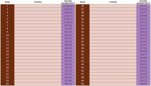
Can you name the world's most densely-populated countries?
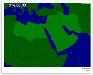
Click on the correct country (no outlines given).
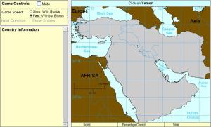
Would you know to locate the geographic items you are asked about? You must point out each exact location on the map.
Locate countries are: Egypt, Iran, Iraq, Israel, Jordan, Kuwait, Lebanon, Libya, Om ...
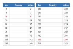
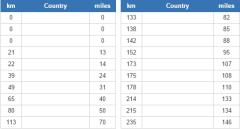
Of those countries that have a land border with a neighbour, what have the shortest?
It is an educational content by JetPunk, site that contains a wide variety of quizzes.
Which countries use the pound as their currency?
It is an educational content by JetPunk, site that contains a wide variety of quizzes.
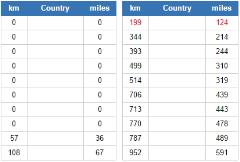
What are the closest countries to the United Kingdom, plus its territories?
It is an educational content by JetPunk, site that contains a wide variety of quizzes.
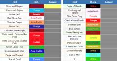
Based on the following symbols and nicknames can you tell the name of the countries which put them on their flags?
It is an educational content by JetPunk, site that contains a wide variety of quizzes.
Which countries are closest to the Red Sea?
It is an educational content by JetPunk, site that contains a wide variety of quizzes.
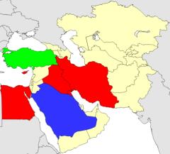
Fill in the map by clicking each selected country in the Middle East, Near East, and Central Asia.
It is an educational content by JetPunk, site that contains a wide variety of quizzes.
Add to Didactalia Arrastra el botón a la barra de marcadores del navegador y comparte tus contenidos preferidos. Más info...


