
Cargando...
Finden
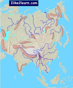
Try to figure out where each given mountain range of Asia is located on the map.
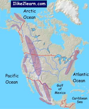
Learn the locations of the North America mountain ranges with this free map quiz.
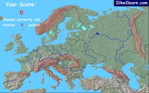
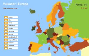
Learn the European mountain ranges with this map quiz.
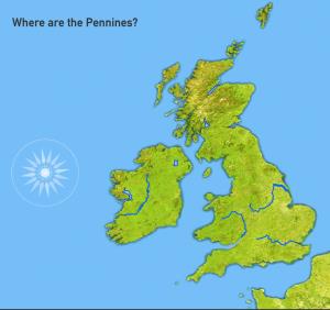
Guess where each given mountain and river of United Kingdom and Ireland is located on the map.
Tren hjernen med geografi.

Você poderia localizar características geográficas que são solicitados no mapa? Você deve marcar uma localização exata no mapa.
Localize características geográficas são: Aconcágua, Ancohuma, Ararat, Et ...

Would you know to locate the geographic items you are asked about? You must point out each exact location on the map.
Locate countries are: Aconcagua, Ancohuma, Ararat, Citlaltépetl, Etna, Fuji, Hekla, ...
Sauriez-vous localiser sur la carte chaque entité géographique? Vous devez indiquer sur la carte exactement où se trouve chacune.
Localiser les entités géographiques sont les suivants: Aconcagua, Ancoh ...
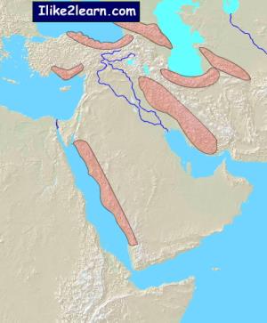
To orientate better in the ancient world, where civilization started, learn the locations of the Middle Eastern mountain ranges.
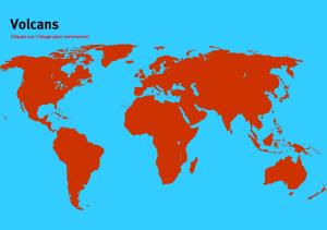
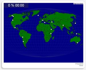
Sauriez-vous localiser sur la carte chaque volcans du monde? Vous devez indiquer sur la carte exactement où se trouve chacune. Es un mapa de la colección EastDock Media.

Könntest du, die geographische Objekte ausfindig machen? Du musst auf die Landkarte genau zeigen, wo jeder sich befindet.
Die geographischen objekte, positionieren sollten, sind: Aconcagua, Ancohuma, A ...

Potrebbe trovare caratteristiche geografiche che vengono richiesti sulla mappa? È necessario indicare ogni posizione precisa sulla mappa.
Individuare le caratteristiche geografiche sono le seguenti: Ac ...
Add to Didactalia Arrastra el botón a la barra de marcadores del navegador y comparte tus contenidos preferidos. Más info...


