
Cargando...
Encuentra
visualización
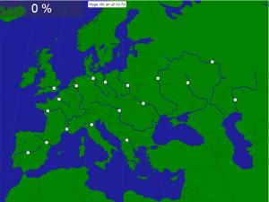
¿Sabrías localizar sobre el mapa los ríos más importantes de Europa? Ponte a prueba con este mapa interactivo de ríos europeos.

Would you know to locate the geographic items you are asked about? You must point out each exact location on the map.
Locate countries are: the Danube, the Dnieper, the Dniester, the Don, the Ebro, the ...
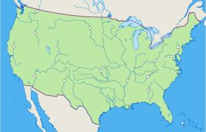
Mapa interactivo de Estados Unidos en el que se trata de identificar los principales ríos que recorren el país
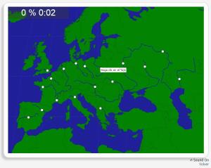
Könntest du, die geographische Objekte ausfindig machen? Du musst auf die Landkarte genau zeigen, wo jeder sich befindet.
Die geographischen objekte, positionieren sollten, sind: Dnjepr, Dnjestr, Don, ...
Añadir a Didactalia Arrastra el botón a la barra de marcadores del navegador y comparte tus contenidos preferidos. Más info...


